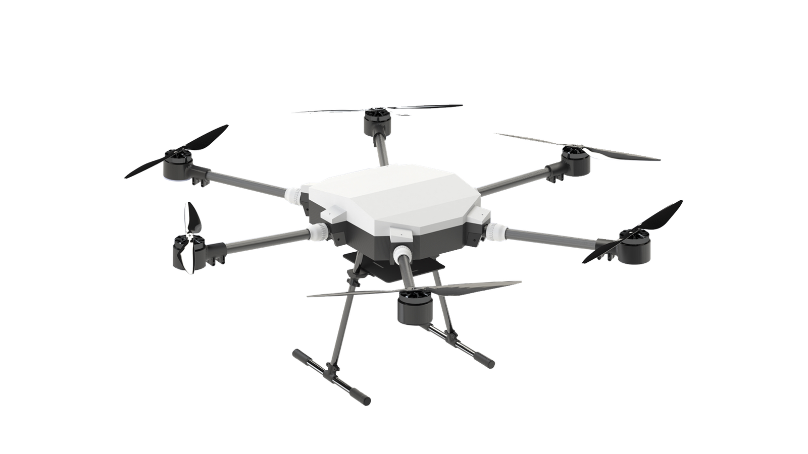
elipptic5G combines cutting-edge AI, 5G connectivity, and autonomous flight to eliminate the cost, risk, and inefficiency of traditional site inspections — with 95%+ detection accuracy and automated reporting.
From autonomous flight to cloud-based post-processing and intelligent reporting — the elipptic5G platform is fully integrated end-to-end.
Our AI-powered hexacopter UAV delivers autonomous precision flights with 3D modelling, object detection, and live 5G streaming. Fully autonomous with RTK positioning and GoPro Hero 12 imaging.
Hardware · UAVThe ground control mobile app for mission planning, autonomous flight execution, live map overlays, and real-time telemetry. Manages the drone with zero human intervention during flight.
Software · MobileCloud-based SaaS post-processing platform. Accepts flight imagery from any drone or camera source — not just elipptic5G hardware. Upload your existing footage and elippticENGINE runs ML object detection, 3D photogrammetry, and generates automated reports. Multi-user access, simultaneous processing.
SaaS · Cloud Platform · Bring Your Own DataAI detection models trained on tens of thousands of annotated images — purpose-built for each vertical.
Autonomous 3D survey of cell towers, identifying antennas, RRUs, MWs, and structural defects. Trained on 10,000+ tower images. Replaces high-risk manual climbing.
Real-time CNN/SSD fire and smoke detection from aerial footage. Trained on 15,000+ annotated images. Ideal for forests, industrial sites, and disaster management.
U-Net architecture for precise power line segmentation in aerial imagery. Trained on 12,000+ annotated images. Reduces manual inspection effort across vast utility networks.
Real-time vehicle and person detection at 30fps. Trained on 50,000+ annotated images. Applicable to smart cities, traffic management, and security operations.
Crop nutrient monitoring, disease detection, soil analysis, and climate change environmental control using multispectral aerial mapping and orthophotographic analysis.
Site progress monitoring, 3D BIM modelling, volumetric measurement, and H&S inspection. Live 5G streaming keeps remote stakeholders informed in real time.
The complete inspection workflow — from takeoff to detailed report — without manual data handling.
Plan the mission in elippticMOBILE. The drone takes off, executes waypoints, captures imagery and sensor data — fully automatically. 5.8GHz FHSS link ensures secure, interference-free control.
Captured data uploads seamlessly to elippticENGINE. Machine learning models run object detection, 3D photogrammetry builds the model, and all findings are indexed and mapped.
A structured, customisable report is generated automatically — complete with coordinates, equipment lists, 360° tower views, flagged defects, and GIS-compatible map exports.
A full suite of AI-powered aerial intelligence services — deployable across industries. Already have drone footage? elippticENGINE post-processes any client footage or camera files and turns raw data into actionable intelligence.
Identifies and classifies up to 80 object types per image using CNN models trained on proprietary and open datasets. Achieves 93–97% accuracy depending on use case.
RTK-enhanced 2.5D orthomap generation with centimetre-level spatial accuracy. Output in GeoTIFF and other GIS-compatible formats for urban planning and environmental monitoring.
Full photogrammetric 3D model creation from flight imagery. Supports BIM for construction, telecom tower documentation, and infrastructure digital twins. 3.5cm GSD resolution.
HD video streaming directly from drone to control room over integrated 5G SimHAT. Low-latency, ideal for disaster response, media, construction progress, and remote inspection.
Orthomosaic analysis with DSM computation for accurate stockpile volumes and land area measurements. GUI visualises results instantly with measurement overlays.
Multi-lane vehicle counting, speed estimation, and congestion detection using fixed or UAV-based platforms. Enhances traffic management and incident response in smart city deployments.
Already flying your own drone or using existing camera infrastructure? Upload footage directly to elippticENGINE and let our AI do the rest. Whether it's DJI, Autel, Parrot, or any standard aerial platform — our cloud pipeline processes your raw imagery and delivers object detection reports, photogrammetric 3D models, georeferenced orthomaps, and structured data exports. Turn any aerial data source into decision-ready intelligence, without changing your hardware.
3Cell was invited by the British Embassy to showcase elipptic5G at NEOM, Saudi Arabia's flagship giga project. The live demonstration highlighted 5G streaming for construction monitoring, real-time truck detection, and traffic flow management across an active desert construction zone.
Backed by UK government R&D funding, ISO-certified, and embedded in the leading UK telecoms and innovation ecosystems.
From a single inspection project through to an enterprise SaaS deployment — every engagement is custom-scoped to your needs.
Talk to our team about your use case. We'll scope a proof-of-concept or full deployment — tailored to your industry and budget.
Technical queries: contact@threecell.co.uk · PoC & Sales: sales@threecell.co.uk